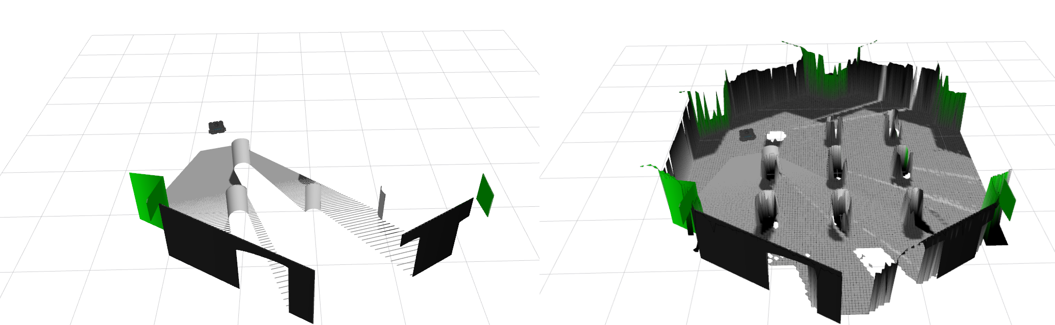
leggedrobotics/elevation_mapping_cupy is a open-source project on GitHub, written primarily in Python. It has 1.0k stars. Elevation Mapping on GPU.
Snapshot summary built from the project's own GitHub metadata — there's no written TopGit review yet. The page will update automatically when a full review is published.
WHY NO REVIEW YET
TopGit writes full reviews for the most-starred, most-requested repositories. This page is a snapshot until then — see the READ ME tab for the original README in full.
The Elevaton Mapping CuPy software package represents an advancement in robotic navigation and locomotion.
Integrating with the Robot Operating System (ROS) and utilizing GPU acceleration, this framework enhances point cloud registration and ray casting,
crucial for efficient and accurate robotic movement, particularly in legged robots.
Key Features
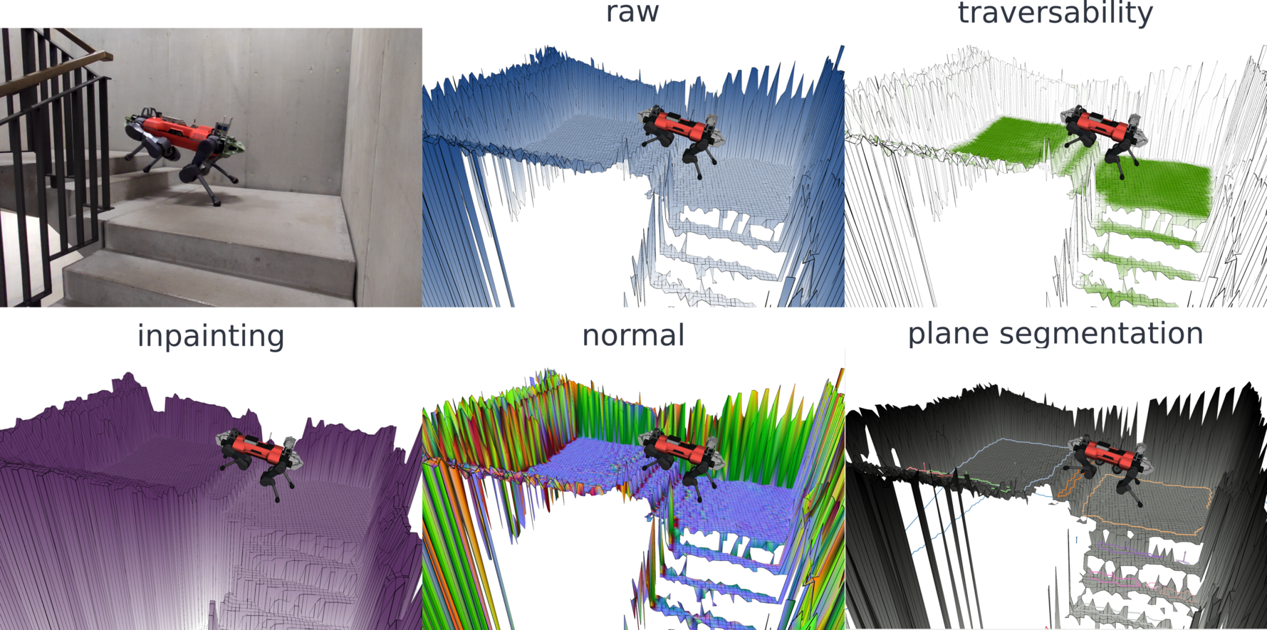
Height Drift Compensation: Tackles state estimation drifts that can create mapping artifacts, ensuring more accurate terrain representation.
Visibility Cleanup and Artifact Removal: Raycasting methods and an exclusion zone feature are designed to remove virtual artifacts and correctly interpret overhanging obstacles, preventing misidentification as walls.
Learning-based Traversability Filter: Assesses terrain traversability using local geometry, improving path planning and navigation.
Versatile Locomotion Tools: Incorporates smoothing filters and plane segmentation, optimizing movement across various terrains.
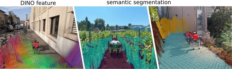
Multi-Modal Elevation Map (MEM) Framework: Allows seamless integration of diverse data like geometry, semantics, and RGB information, enhancing multi-modal robotic perception.
GPU-Enhanced Efficiency: Facilitates rapid processing of large data structures, crucial for real-time applications.
Overview
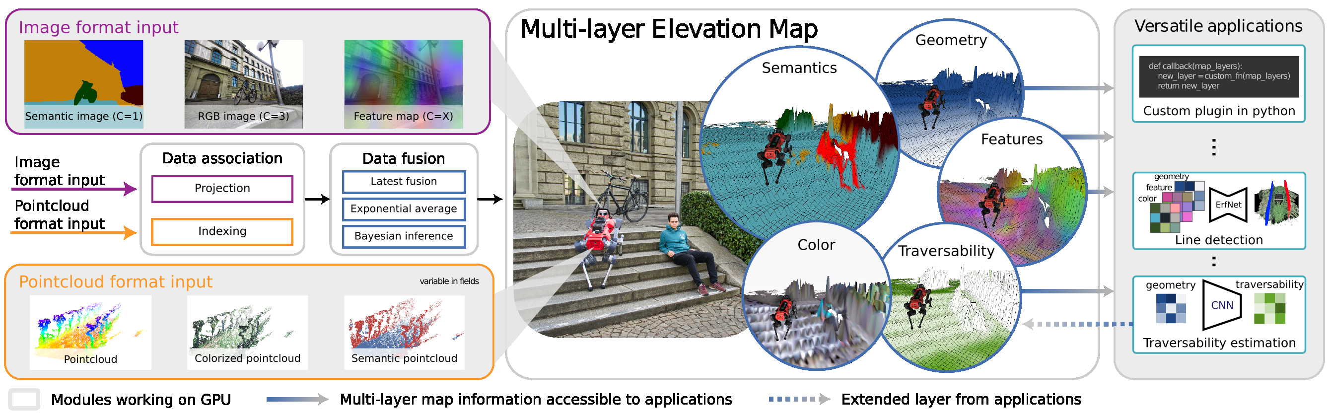
Overview of our multi-modal elevation map structure. The framework takes multi-modal images (purple) and multi-modal (blue) point clouds as
input. This data is input into the elevation map by first associating the data to the cells and then fused with different fusion algorithms into the various
layers of the map. Finally the map can be post-processed with various custom plugins to generate new layers (e.g. traversability) or process layer for
external components (e.g. line detection).
Citing
If you use the Elevation Mapping CuPy, please cite the following paper:
Elevation Mapping for Locomotion and Navigation using GPU
Elevation Mapping for Locomotion and Navigation using GPU
@inproceedings{miki2022elevation,
  title={Elevation mapping for locomotion and navigation using gpu},
  author={Miki, Takahiro and Wellhausen, Lorenz and Grandia, Ruben and Jenelten, Fabian and Homberger, Timon and Hutter, Marco},
  booktitle={2022 IEEE/RSJ International Conference on Intelligent Robots and Systems (IROS)},
  pages={2273--2280},
  year={2022},
  organization={IEEE}
}
MEM: Multi-Modal Elevation Mapping for Robotics and Learning
Gian Erni, Jonas Frey, Takahiro Miki, Matias Mattamala, Marco Hutter
@inproceedings{erni2023mem,
  title={MEM: Multi-Modal Elevation Mapping for Robotics and Learning},
  author={Erni, Gian and Frey, Jonas and Miki, Takahiro and Mattamala, Matias and Hutter, Marco},
  booktitle={2023 IEEE/RSJ International Conference on Intelligent Robots and Systems (IROS)},
  pages={11011--11018},
  year={2023},
  organization={IEEE}
}
Quick instructions to run
Installation
First, clone to your catkin_ws
mkdir -p catkin_ws/src
cd catkin_ws/src
git clone https://github.com/leggedrobotics/elevation_mapping_cupy.git
Then install dependencies.
You can also use docker which already install all dependencies.
When you run the script it should pull the image.
cd docker
./run.sh
You can also build locally by running build.sh, but in this case change IMAGE_NAME in run.sh to elevation_mapping_cupy:latest.
For more information, check Document
Build package
Inside docker container.
cd $HOME/catkin_ws
catkin build elevation_mapping_cupy
catkin build convex_plane_decomposition_ros  # If you want to use plane segmentation
catkin build semantic_sensor  # If you want to use semantic sensors
Is leggedrobotics/elevation_mapping_cupy open source?
Yes — leggedrobotics/elevation_mapping_cupy ships under the MIT license, which makes its source code freely readable (and, depending on license terms, forkable and reusable). Source: github.com/leggedrobotics/elevation_mapping_cupy.
What is leggedrobotics/elevation_mapping_cupy?
leggedrobotics/elevation_mapping_cupy (leggedrobotics/elevation_mapping_cupy) is a Python project on GitHub. From the project's own README: Elevation Mapping on GPU.
Where do I read more about leggedrobotics/elevation_mapping_cupy?
This TopGit page is a snapshot — the READ ME tab shows the project's own README content (links stripped, images preserved). The GitHub repository at github.com/leggedrobotics/elevation_mapping_cupy is the definitive source.
Read full README in the tab above.
Curious whether elevation_mapping_cupy is right for you?
Let ChatGPT, Claude, or Perplexity look into it — click below and see what AI actually says about elevation_mapping_cupy.
 /elevation_mapping_cupy